Electrical Resistivity Tomography (ERT) Survey
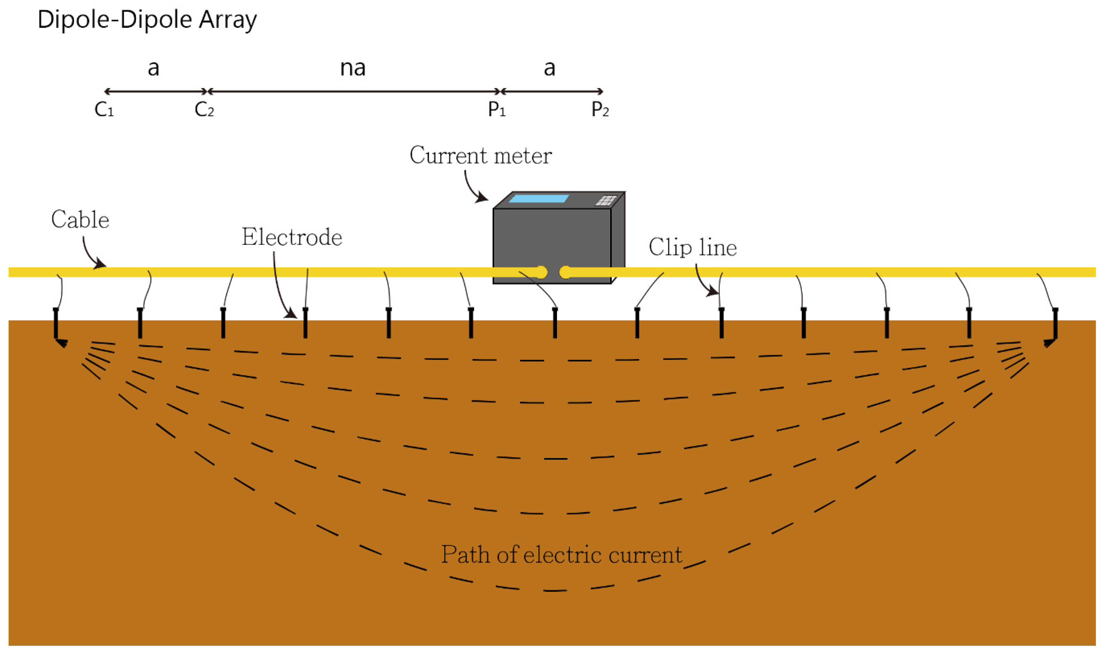
At MHS, we conduct Electrical Resistivity Tomography (ERT) surveys using a method that involves introducing a DC electrical current into the ground through two electrodes while measuring surface voltages. This process allows us to determine the resistivity, which is inversely related to conductivity, of subsurface materials. Resistivity serves as a key indicator of how easily an electrical current can pass through a material. The diversity in resistivity responses of subsurface materials stems from factors like saturation, ion concentration, faulting, and jointing. To gather ERT data, we arrange a linear array of electrodes across the target area, linking them to a resistivity transmitter/receiver and electrode control box. Varied electrode spacings and arrangements are employed based on survey objectives and local geological conditions. Preliminary Electromagnetic (EM) surveys are often conducted to identify optimal positions for ERT lines. By utilizing resistivity techniques, we generate cross-sectional maps of lateral subsurface features, enabling specialized data interpretation to delineate the vertical extent of inorganic contamination.