3-D Modelling and Volume Estimation
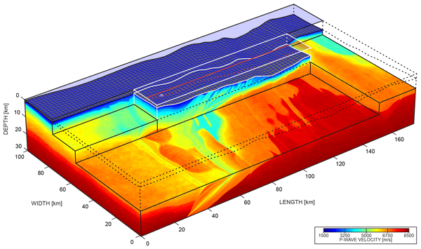
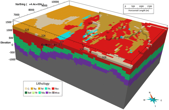
The process of developing a comprehensive 3-D model involves the systematic collection, meticulous processing, and skillful fusion of subsurface geophysical datasets obtained from multiple orientations. The primary goal is to construct an exhaustive representation of the subsurface environment, encompassing delineation of contaminant zones, characterization of underground structures, and identification of valuable mineral deposits. This intricate endeavor combines the use of planar conductivity measurements derived from electromagnetic (EM) surveys with the vertical conductivity values acquired through electrical resistivity tomography (ERT) surveys. Through this integration, a sophisticated and intricate 3-D model is meticulously crafted. The resultant model serves as a powerful tool for more accurately estimating the extent of impacted regions, thereby enabling refined calculations of volume and contributing to informed decision-making in various domains.